Transforming Construction Insights
Revolutionize Your Project Tracking with Drone Technology
Othomosaics
3D Models
Enhancing Reporting Accuracy
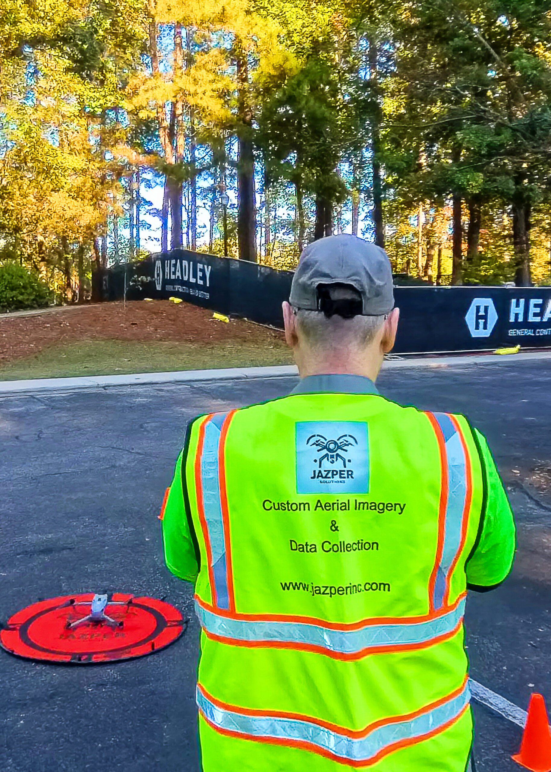
The Role of Drone Imagery in Construction

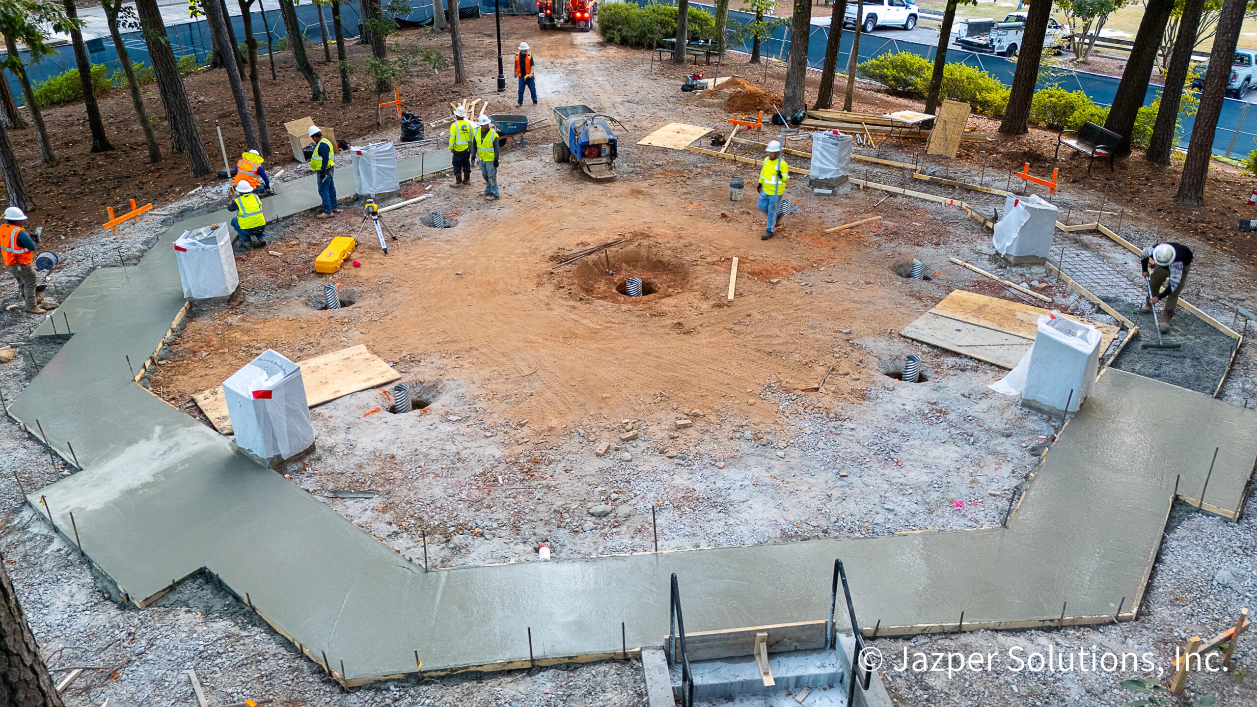
Drone imagery (orthomosaics, 3D models, point clouds, time-lapse, and 360° tours) solves a wide range of real-world problems on construction sites and directly aids dozens of critical decisions. In the fast-paced world of construction, keeping track of progress is crucial. Drone imagery offers a revolutionary approach, providing real-time, accurate data that enhances traditional reporting methods. By integrating advanced technologies like othomosaics and 3D models, project managers can make informed decisions swiftly and effectively.
Solving Common Reporting Challenges
Addressing Construction Reporting Issues with Drones
Traditional construction progress reporting often faces challenges such as delayed updates, human error, and limited site visibility. Drone imagery tackles these issues by delivering comprehensive, up-to-date visuals and data. This technology minimizes errors, accelerates reporting processes, and provides a holistic view of the construction site, enabling better project management and strategic planning.
Imagine this: it’s the 25th of the month. The owner wants the progress payment application. The superintendent swears the concrete pour is 100 % complete. The quantity surveyor says it looks more like 78 %. Everyone opens their laptops, pulls up the latest drone flight from two days ago, and in 30 seconds the argument is over. That single moment is why drone imagery has gone from “nice-to-have marketing footage” to non-negotiable scope on projects and infrastructure programs.
Here’s the real-world list of expensive, painful problems that drone imagery solves every week on job sites — and the decisions it makes instant, objective, and indisputable.
Payment Disputes Vanish Overnight
Manual % complete guesses routinely differ by 5–20 %. One bi-weekly orthomosaic + volume report gives everyone the same number. Owners pay what’s actually built. Contractors get cash flow they deserve. Lenders sleep better.
“Did They Build It in the Right Place?”
Overlay the design file on the latest point cloud. Columns 18 inches off? Footings encroaching the property line? Curbs poured 2 ft from where the civil set them? It’s visible in seconds instead of months later when the framer screams.
Remote Executives Actually Know What’s Going On
CEOs, lenders, and out-of-town owners log into a web viewer and fly the entire site themselves — no hard hat, no flight, no wasted day. Decisions that used to wait two weeks now happen in the same Zoom call.
Safety Violations Are Obvious from 400 ft Up
Open trenches without barricades, missing guardrails, cranes swinging over active roads, poor housekeeping — all visible in one high-res ortho. Safety managers issue corrections the same day instead of after an incident.
RFIs and Change Orders Become Bulletproof
Timestamped, georeferenced imagery is the single best evidence in mediation. “Here’s the rock we hit on October 14th” is a lot stronger when you can zoom to the exact coordinate.
Marketing & Stakeholder Wins Come for Free
That same data produces jaw-dropping 4K time-lapses and fly-through videos that win bids, calm nervous neighbors, and make owner board meetings actually enjoyable.
As-Built Documentation Is Finished When the Job Is Finished
Final orthomosaic, point cloud, and textured 3D model become the permanent record handed to facilities management — no more “we’ll survey it later” surprises.
Rework and Insurance Claims Are Proven (or Disproven) Instantly
Storm damage? Unauthorized subcontractor work? Demo quantification? The drone archive is date-stamped, impartial evidence accepted by mediators and insurers alike.
Enhancing Decision-Making
Drone Imagery in Construction
Five years ago, drone flights were a line item owners tried to cut. Today, on any well-run job, the question isn’t “Should we fly drones?” It’s “Are we flying often enough?”
Because when everyone can literally see the same picture — from the superintendent in the trailer to the private-equity partner in New York — construction finally starts behaving less like educated guessing and more like manufacturing.
And that’s not marketing hype. That’s just what happens when you replace “I think” with “Here, look for yourself.”
In the realm of construction, making informed decisions is crucial for the success of any project. Drone imagery provides a comprehensive view of the site, enabling project managers to assess progress, identify potential issues, and make timely decisions. By offering real-time data and visual insights, drones help streamline communication among stakeholders, ensuring everyone is aligned with the project’s objectives and timelines.
The Bottom-Line Math
2024–2025 Industry Data
- Typical ROI: 8–15× the cost of the drone program in the first year
- Average savings: 1–5 % of total project value (that’s $1–5 M on a $100 M job)
- Dispute reduction: 70–90 % fewer progress-related claims
- Schedule compression: 2–6 weeks faster closeout on most projects
Advanced Drone Features
Key Features of Drone Imagery
Othomosaics
3D Models
Unlocking the Future of Construction
Harnessing Drone Imagery for Enhanced Construction Reporting
