Revolutionize Your Construction Monitoring
Harness the Power of Drone Imagery for Construction Progress Reporting
Drone Technology Advantage
The Revolution in Construction Progress Reporting
Why Choose Drone-Based Reporting?
Unleash the Future of Construction Monitoring
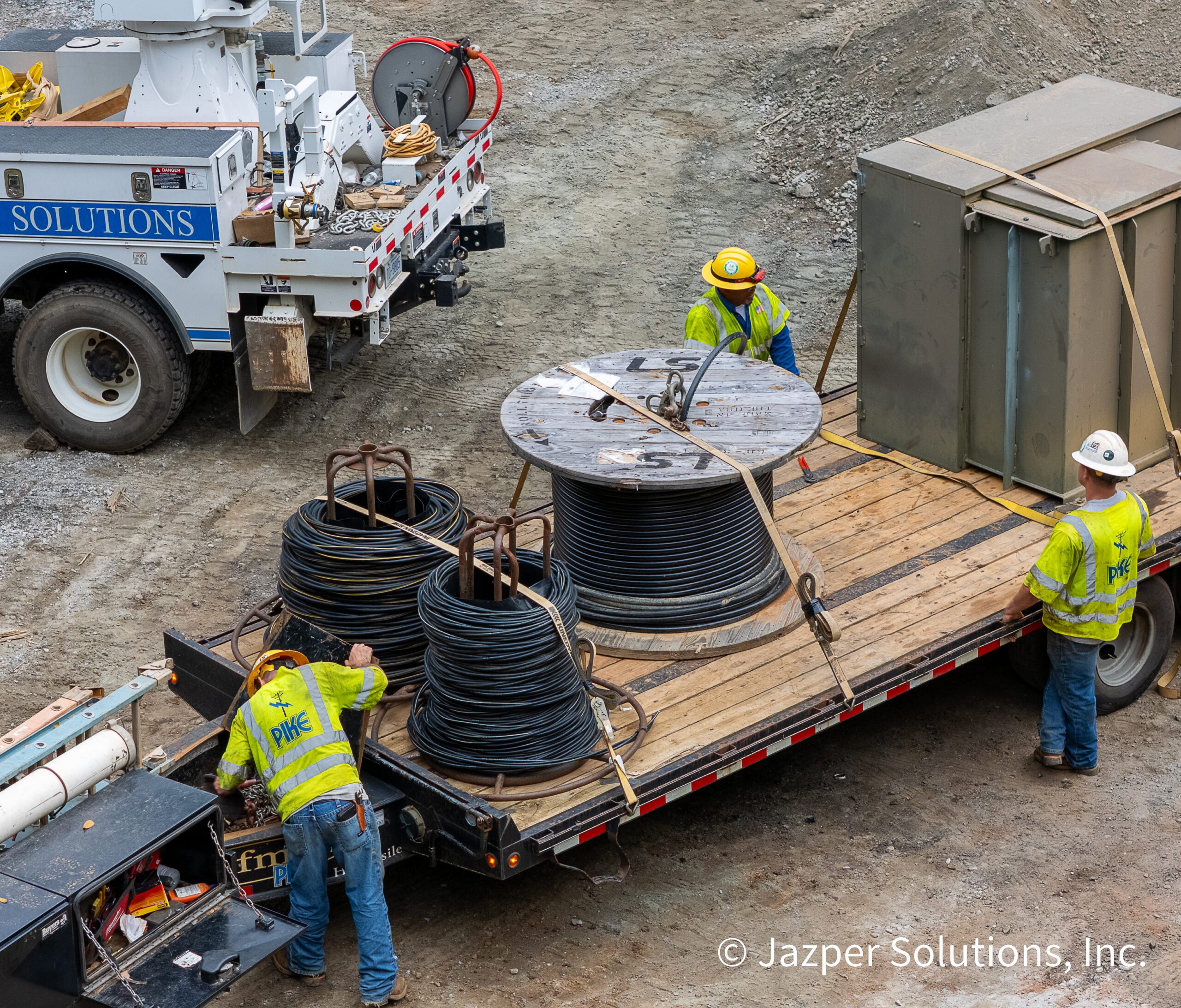
In the fast-paced world of construction, staying ahead means having real-time visibility into every phase of your project. Traditional ground-based surveys are time-consuming and limited in scope. With Jazper Solutions, our FAA certified pilots execute custom flight plans tailored to your site’s unique needs, capturing high resolution data without disrupting operations.
Our Drone Solutions Provide
- Unmatched Accuracy: Geotagged data for precise measurements and change detection.
- Cost Efficiency: Reduce site visits and manual labor while accelerating decision-making.
- Enhanced Safety: Aerial perspectives minimize risks to personnel on the ground.
- Stakeholder Alignment: Share immersive visuals to keep investors, clients, and teams informed.
Whether you’re tracking a multi-phase build or documenting milestones, our tools turn raw data into compelling narratives that build trust and protect your assets.
Revolutionize Your Project Tracking
Discover how drone imagery is reshaping the landscape of construction progress reporting, providing unparalleled accuracy and efficiency.
Our Core Services for Construction Monitoring
Comprehensive Drone Solutions
High Resolution Imagery
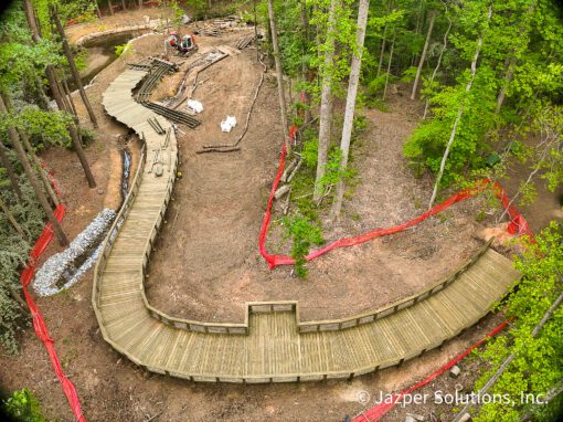
Capture crystal-clear 4K aerial photos that reveal fine details—from foundation pours to structural completions. Ideal for daily inspections, compliance documentation, and progress snapshots. Our imagery serves as the foundation for all reporting, ensuring every angle is covered without blind spots.
3D Models and Point Clouds
Elevate your reporting with detailed 3D reconstructions of your construction site. Using photogrammetry, we generate immersive models that allow virtual walkthroughs, clash detection, and BIM integration. Visualize progress in three dimensions, forecast potential issues, and share rotatable models with your team for collaborative planning.
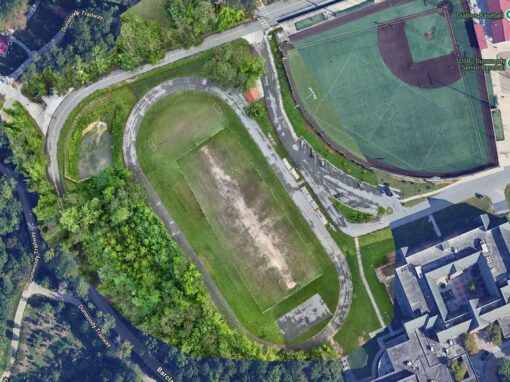
Orthomosaic Maps
Transform your site into a seamless, interactive map with orthomosaics—stitched aerial images that provide bird’s eye overview. Track volume changes, measure distances, and overlay annotations to highlight key developments. Weekly orthomosaic deliveries keep your project timeline crystal clear, making it easy to compare “before and after” states.
Time-Lapse Sequences
Bring your project’s evolution to life with dynamic time-lapse videos. Compiled from scheduled drone flights, these sequences showcase transformations over days, weeks, or months—perfect for marketing materials, investor updates, or internal reviews.
360° Panoramic Views
Immerse stakeholders in your site with full 360° virtual tours and panoramic imagery. These interactive panoramas offer clickable hotspots for detailed views, enabling remote inspections and enhanced presentations. From crane-top perspectives to full-site sweeps, panoramics foster engagement and provide a holistic understanding of progress.
Key Features of Our Drone Imagery
The Benefit of Drone-Based Reporting
By leveraging these technologies, clients can experience faster project timelines and reduced rework through early issue detection. Our cinematic aerials not only document progress but also align teams, proving ROI at every stage.
| Feature | Service | Benefit to Your Project |
|---|---|---|
| Custom Flight Planning | Tailored drone missions based on your project’s geometry and objectives. | Precise data capture with zero downtime. |
| AI-Enhanced Analysis | Integration of AI tools for automated insights, like progress detection. | Faster reporting and predictive analytics. |
| Secure Data Delivery | Cloud-based access to all deliverables, with options for exports. | Seamless integration into your workflows. |
| Weekly/Monthly Reporting | Scheduled updates including orthomosaics, models, and time-lapses. | Consistent tracking without extra effort. |
| No Upsell Policy | Free consultations to scope your needs—no hidden fees. | Transparent pricing and customized value. |
The Power of Orthomosaic Maps


The Future of Construction Monitoring
3D Models and Point Clouds
Capturing Construction Progress
Immersive Site Visualizations
Drone Imagery Innovations
Key Features of Drone Imagery
High-Resolution Imagery
Orthomosaic Maps
3D Models and Point Clouds
Explore Our Imagery